
- How a shared digital model enabled holistic urban development in Oslo
The digital backbone of Bjørvika
Bjørvika in Oslo
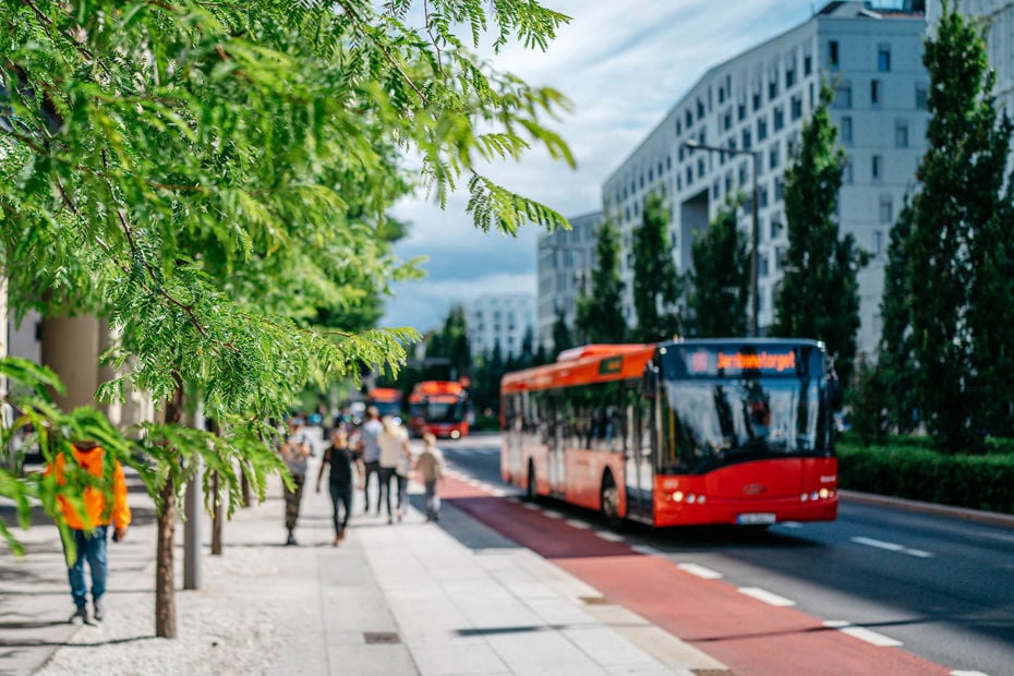
Bjørvika has become the bustling hive a vibrant district is meant to be. Its streets are alive from morning to night. Developed as a mixed‑use neighbourhood, Bjørvika brings housing, workplaces, cultural institutions, retail and public services together in one tightly connected urban fabric rather than separating them into zones. A shared digital 3D model has been a key to this success.
In Bjørvika, infrastructure, the environment and buildings work in harmony to create an urban setting that draws people towards the waterfront. A walk along the inner Oslofjord brings you past office workers heading to their jobs, friends on their way to a café or concert, tourists stopping to take photos, and children running towards the water with towels slung over their shoulders.
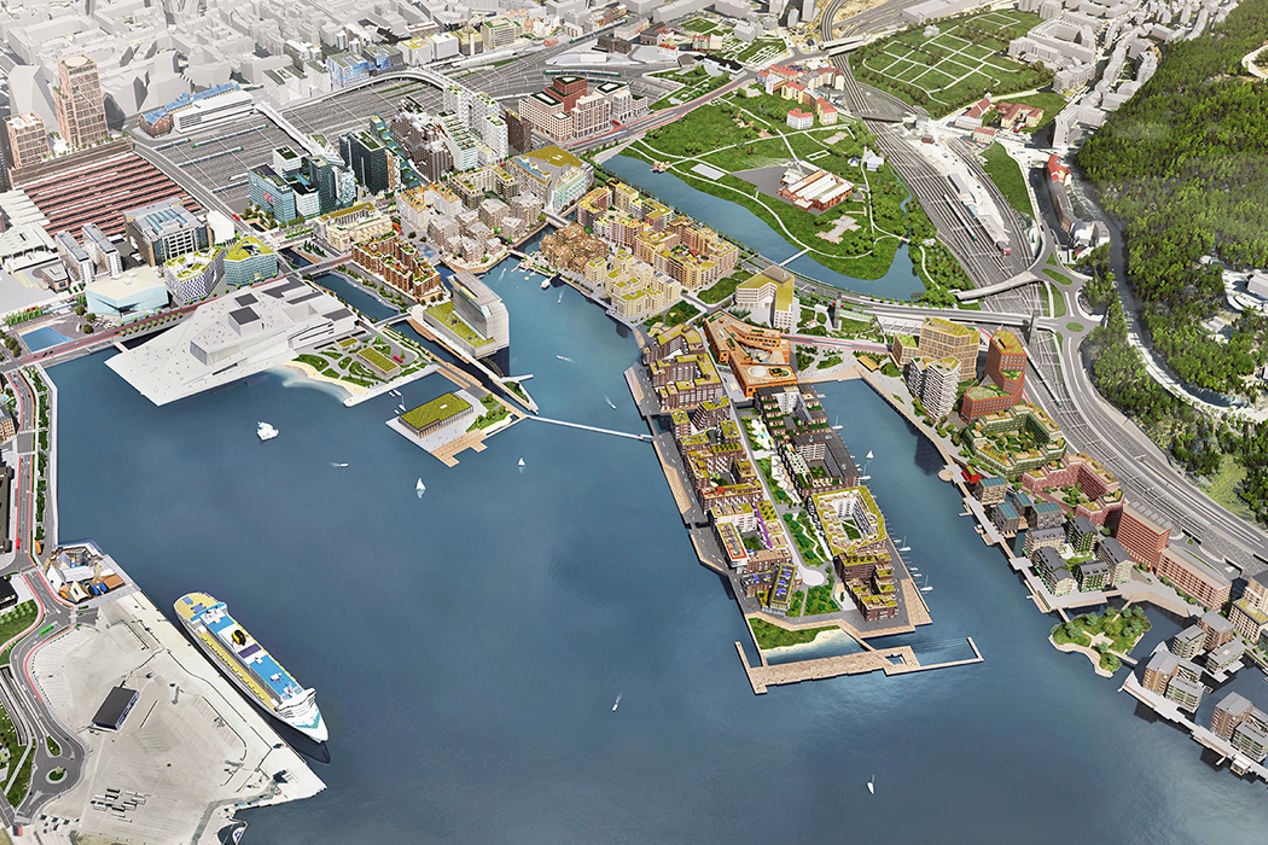
Extract from the Bjørvika model | Ill. ViaNova”
‘Bjørvika shows what happens when we plan a district as a coherent ecosystem rather than as isolated projects,’ says Eivind Hartmann, former project manager for the planning of Bjørvika in Oslo Municipality and Head of Planning at Hav Eiendom from 2009 to 2020.
In the early 2000s, Bjørvika was a place people hurried past. The E18 motorway dominated the area, with queues, noise and exhaust shaping everyday life, and tens of thousands of cars using Bjørvika as a thoroughfare. Between the road structures were remnants of port activity, forming an additional barrier between the city and the fjord. Oslo needed to reclaim its waterfront, and Bjørvika needed a new identity.
“Bjørvika shows what happens when we plan a district as a coherent ecosystem.”
Eivind HartmannFormer project manager for the planning of Bjørvika in Oslo Municipality.
Oslo Municipality takes action
In 2003, Oslo Municipality adopted a zoning plan intended to reverse the area’s trajectory. The vision behind the plan was to open the city towards the fjord, develop a new central district with housing, workplaces and cultural venues, and create a ‘fjord city’ with high urban quality.
‘We wanted to restore Oslo’s connection to the waterfront while creating a vibrant district for the future. This has been a priority throughout the entire development of the area,’ says Hartmann.
With the urban plan as its foundation, the municipality began removing the major barriers. A major milestone in the long‑term plan came in 2010, when the E18 motorway was placed in a tunnel beneath Bjørvika, opening the way for reconnecting the city with the fjord.
Oslo chose open public spaces, a wide and continuous harbour promenade, short distances and a clear prioritisation of pedestrians and cyclists. In this way, a district emerged where movement, gathering and everyday encounters are a natural part of urban life. The Opera House already stood as a landmark, marking the beginning of a new era.
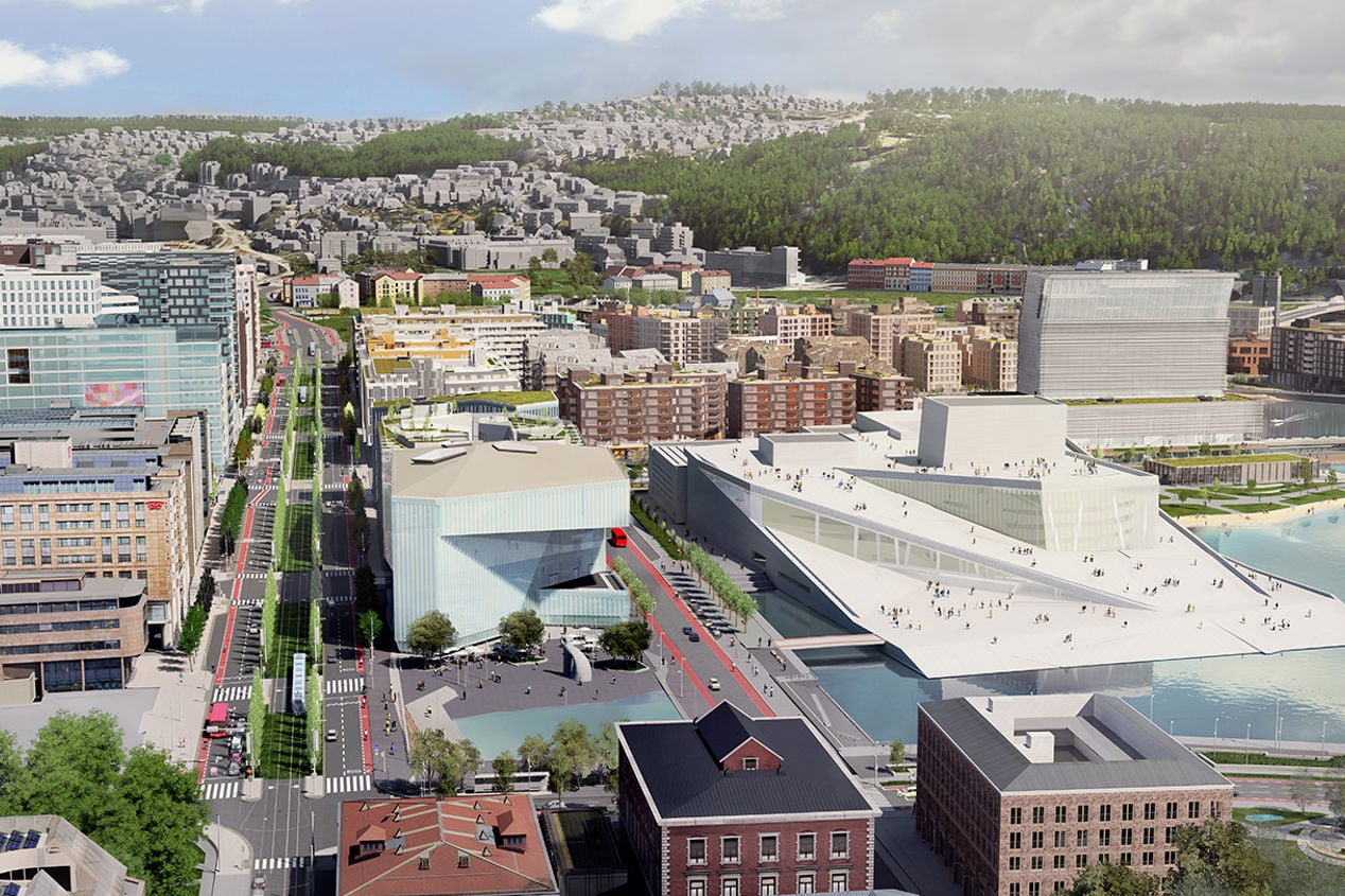
Extraction of Bjørvika from the Bjørvika model
The quiet success factor
Urban development is complex, and many elements must work together to achieve a good outcome. A strong idea or plan alone is no guarantee of success. Measures must interact with existing structures to create coherence, not a collection of standalone buildings and elements that fail to form a whole.
This is where Bjørvika is unique in a Norwegian context: all projects have been integrated into a shared digital 3D model. Throughout Bjørvika’s development, this common model has been an integral part of the urban planning process, on par with the physical masterplan. Hartmann believes it has strengthened the municipality’s ability to steer development in line with the plan’s intentions.
‘The digital model has made it possible to view individual projects in context, both for us and for private developers. Changes planned in a single block or on an individual plot could be assessed early in the process against their consequences for public spaces, sightlines, infrastructure and neighbouring buildings,’ Hartmann says.
The model was established by ViaNova as early as 1998 and has, since 2003, brought together mapping data, geometry, zoning information, property boundaries, technical infrastructure and three‑dimensional building volumes into one shared digital reality.
 Torbjørn Tveiten, ViaNova
The model has served as a unified digital representation of the district, bringing all data together in a single shared model. Today, it stands as an essential digital backbone for everything that has happened, is happening and will happen in Bjørvika,’ says Torbjørn Tveiten of ViaNova.
Significant transfer value
Norwegian cities have changed dramatically over the past decades, but not all developments succeed — often because the overall coherence is missing. Bjørvika shows that digital collaboration can be just as important as physical planning.
Read more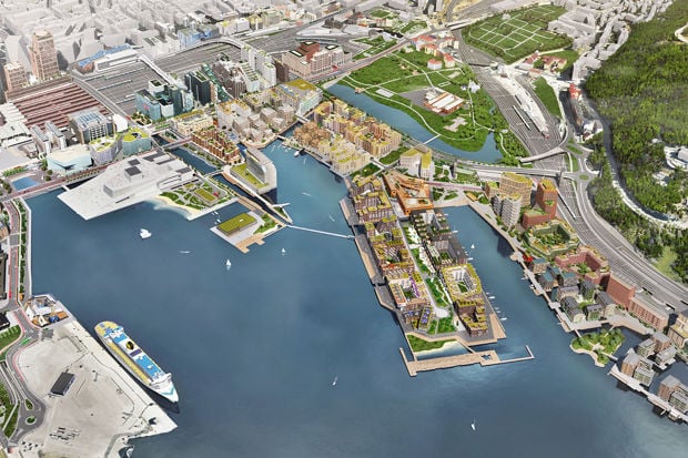
A fantastic tool
For developers and other stakeholders, the Bjørvika model has been worth its weight in gold. When both the municipality and developers worked from the same digital foundation, processes became more predictable, dialogue more precise and the risk of costly redesigns significantly lower.
 Bernt Aasenhuus, Hav Eiendom
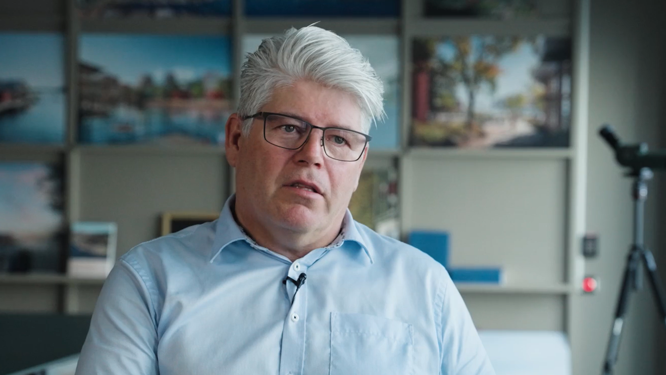
-‘Those of us with projects in Bjørvika continuously deliver model data into the main model, and we’ve been doing so since 2003. The advantage of having everything gathered in one model is that you can see the area as a whole. The model shows all geometry. You can view every building in detail. You can see all infrastructure in detail. Through the tool, you can even visualise conditions such as sun and shadow. This is of great value to us as developers,’ says Bernt Aasenhuus, Project Director at Hav Eiendom.
The Bjørvika model has been used in every phase — from early‑stage ideas and sketching to completion and sales. It has been crucial for a large number of individual projects and actively used by many parties. The model is highly visual, and you can move through it much like in a game. This has helped make it an effective dialogue tool.
‘We use the model in communication with others — the Planning and Building Services, other municipal agencies, neighbours, homebuyers and other stakeholders. It gives them the opportunity to see what the area will look like once it is fully built,’ says Aasenhuus.
Municipal ownership
Oslo Municipality took early ownership of the model and established a cooperation agreement requiring all actors in the district to supply data, while granting them rights to use the model in their own project development. The agreement ensured that the model was always up to date — and that everyone worked from the same foundation. The municipality also introduced a scheme in which participants pay an annual fee to finance further development.
‘A clear success factor has been that Oslo Municipality took ownership and ensured that all actors in Bjørvika committed to delivering data into the model. Establishing a comprehensive model has been incredibly important. It also helped visualise the zoning plan and the elements essential to the overall coherence,’ says Tveiten.
Continuous updates have given both the municipality and developers a shared decision‑making basis and a working method that reveals conflicts early and strengthens precision in planning. The planning of Bjørvika has not been without conflict. Heritage authorities, for example, have been highly concerned with how projects affect the many historic sight sectors in this part of the city, where the oldest Oslo can still be read in Gamlebyen and the Medieval Park.
‘A good example is the requirement that the three central north–south street axes in the protected area at Grünerløkka should retain the green Ekeberg slope as a backdrop. This meant that the so‑called Barcode row had to be designed with three recesses in the sequence of cornice heights. With the Bjørvika model, it was easy to pinpoint their precise location,’ Tveiten says. ‘Few people notice this connection today, but for the curious eye at Grünerløkka, it works.’
Why we write about the cities of the future
We write about the cities of the future because it is in cities that society’s biggest challenges hit us hardest, and where the opportunities are greatest. Urbanisation, climate change, the energy transition, mobility and social inclusion all converge in the same place. We care about this because the choices we make today will shape everyday life for people for generations to come.
Cities must work both now and far into the future. That demands holistic thinking, where land use, transport, energy, nature, urban life and safety are understood together. When we densify and transform existing areas, it’s about creating vibrant, inclusive and resilient cities — places where people can live, work and move in sustainable ways.
Together with our clients, we develop solutions that meet today’s needs and tomorrow’s demands.
Related articles
All articlesRelated articles
All articles
That’s why we talk about the cities of the future
It is in our cities that societal challenges confront us, but it is also where the greatest opportunities lies.
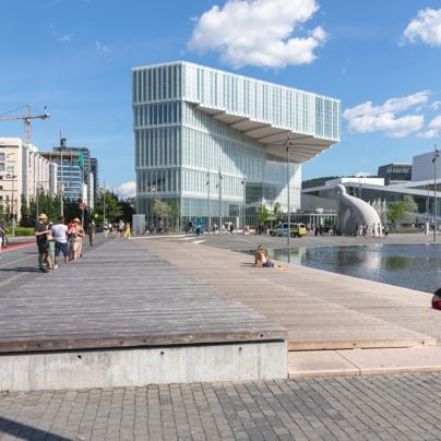
The cultural institutions that changed Oslo
Cultural landmarks of Bjørvika
What makes a city feel safe?
People, activity and a sense of belonging are essential.